Drawing
back the curtains, the early morning view from my small bedroom window at the
Estancia Menelik is filled with the stunning Andes of the Perito Moreno National Park – Argentina’s remotest national park. Before breakfast I wander
around outside taking photos of this unique circumstance and contemplate what
happens next. The daily activities at the estancia are already underway as the
farm’s gauchos round-up their horses.
Drawing
back the curtains, the early morning view from my small bedroom window at the
Estancia Menelik is filled with the stunning Andes of the Perito Moreno National Park – Argentina’s remotest national park. Before breakfast I wander
around outside taking photos of this unique circumstance and contemplate what
happens next. The daily activities at the estancia are already underway as the
farm’s gauchos round-up their horses. |
| Estancia Menelik looking west-ish towards the Andes |
 |
| Estancia Menelik looking east-ish (apologies for the dog!) |
After
breakfast and goodbyes, Lisi, Jane and I – still bewildered with the remote new world we have discovered over
the past few days – decide to drive the 20 or so miles west to the park on the
remaining petrol fumes in our tank, along the dirt road from nowhere to
nowhere, before heading off into who knows where for the long drive to El
Calafate – our ultimate objective for the day. Early morning rheas, presumably
after early morning worms, scatter as we approach the mountains.
 The park
is a heady, geological cocktail of wild mountains and stunning lakes dominated
by the imposing peak of Monte San Lorenzo (also known as Monte Cochrane), which
marks the Chile-Argentina border, the north side of which is not too distant
from Valle Chacabuco in Chile, where we started this journey; since early
morning yesterday we have driven a horse-shoe of a couple of hundred miles. We
keep pushing, like surfers promising themselves that the next wave will be
their last of the day, for the best view, limited by our time and fuel
situation. Eventually we stop for a few minutes on the dirt road, take our
obligatory snaps then head back, as the Andes diminish in our rear view mirrors
for the second time in two days.
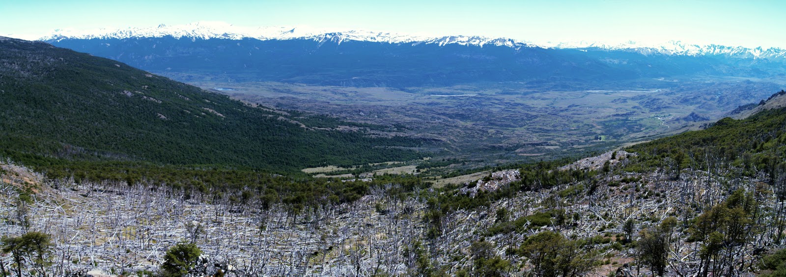
The park
is a heady, geological cocktail of wild mountains and stunning lakes dominated
by the imposing peak of Monte San Lorenzo (also known as Monte Cochrane), which
marks the Chile-Argentina border, the north side of which is not too distant
from Valle Chacabuco in Chile, where we started this journey; since early
morning yesterday we have driven a horse-shoe of a couple of hundred miles. We
keep pushing, like surfers promising themselves that the next wave will be
their last of the day, for the best view, limited by our time and fuel
situation. Eventually we stop for a few minutes on the dirt road, take our
obligatory snaps then head back, as the Andes diminish in our rear view mirrors
for the second time in two days. |
| Perito Moreno National Park |
We settle
into our customary physical and mental states and progress along the empty
dirt road, trailing a cloud of dust, towards the Ruta Cuarenta (Ruta 40).
Suddenly, a dark-coloured aeroplane swoops low from nowhere immediately in
front of us. Closer inspection reveals finger-like terminal wing feathers
indicating that this plane is an Andean condor. It glides a few feet above the
ground, watching us for a few seconds, before deciding we are too boring to
bother with and veers off, skimming over the low mounds of vegetation into the
distance.
 |
| Alejandre |
 |
| Eyes onto nothing, from Alejandre's lounge window |

Back on
the Ruta 40 we head south. Re-assuming our Nissan mental and physical driving
positions I, for one, feel that I am becoming desensitized to the spectacular
emptiness. By way of alleviation we enter ipod heaven and play Mumford and Sons
and Adele’s “spectacular new album” 21 – the sound track of my entire journey
to date, with its songs emanating from every bar, shop and car radio from
Appalachia to Patagonia, and everywhere in between.
Most of
the Ruta 40, save a few kilometres near Gobernador Gregores, is dirt road,
although over large distances is at least relatively straight and reasonably
graded. It is the subject of a major national economic undertaking,
being upgraded over hundreds and hundreds of miles to eventually become a
black-top, tarmac road. Lisi and I wonder at the cost, time-scale and necessity
of this. Bizarrely, as we trail our cloud of dust ever southwards, we encounter
small gatherings of bright yellow earth-moving and road-making machinery in the
middle of nowhere wondering how on earth they got here and where are the people
who use them? In this land of the real dinosaurs, they appear simultaneously
unsettling, but normal. (Or maybe my brain has finally forgone trying to
understand normality any more).
We reach
Gobernador Gregores - a reasonably-sized, windswept town
with one main street and lots of new buildings. Unsurprisingly, the only
functional petrol station for hundreds of miles in any direction is rather
busy. I ask the station chap, in rubbish Spanish, how we can get back on the
Ruta 40 without driving back the way we have come. Even if I understood Spanish
properly I doubt his grunted instructions would have made sense. So, we just
take off and head in what seems to be the right direction (after cruising up
and down the main strip a few times to work out what was what). Eventually we
stumbled on the only road going south and, ignoring a road-closed sign, took a
40-mile, half-built, black-top road back to the Ruta 40.
For the
rest of the day we drive (almost) on the Ruta 40, on the ripio tracks alongside
the newly-constructed tarmac strips, but we are not allowed to actually drive
on it. Tantalisingly, the ripio route regularly crisscrosses the new tarmac;
occasionally feeling brave, we ignore the signs and revel in the pleasure of a
few miles of vibration and dust free motoring, singing to Adele.
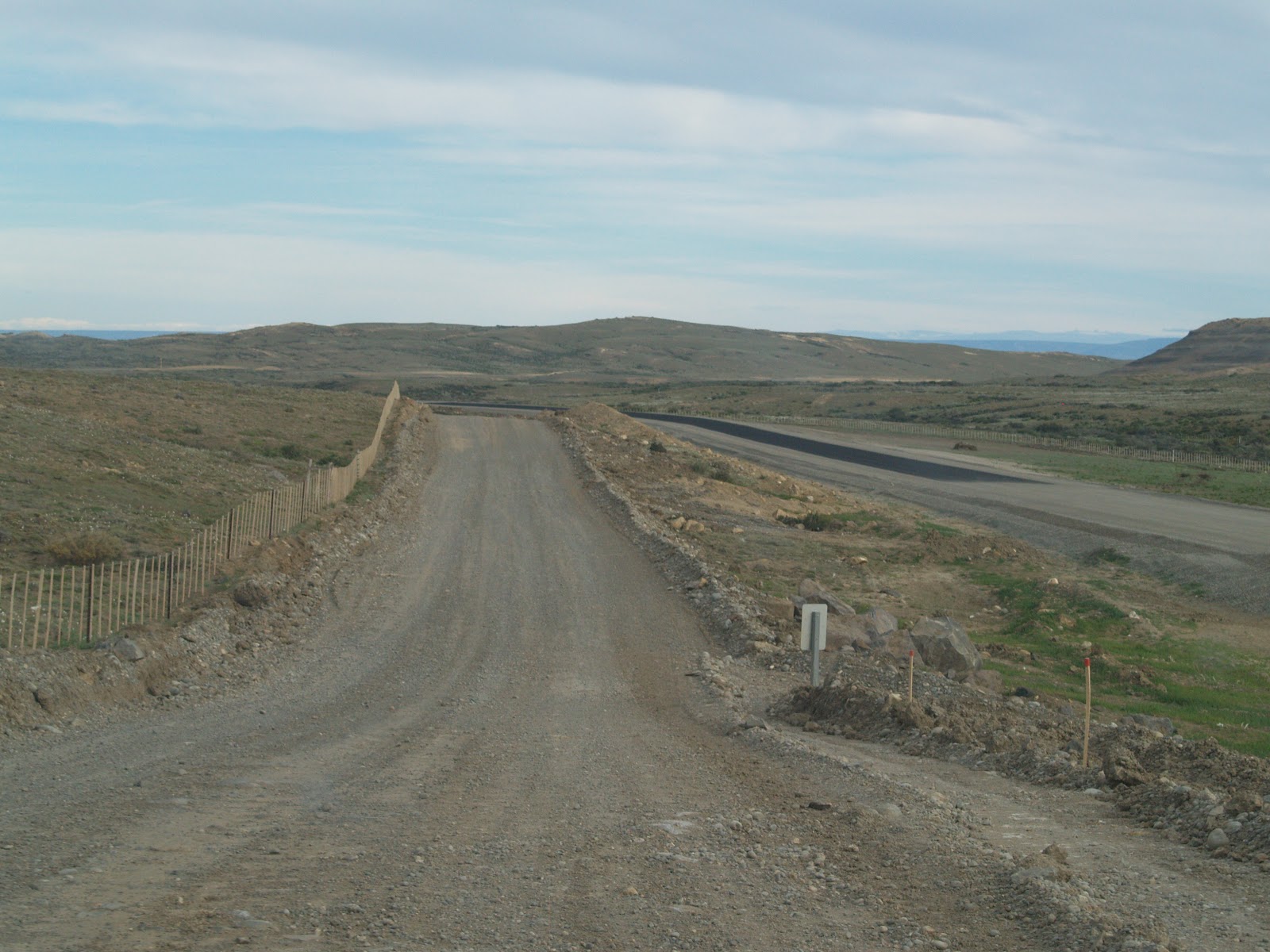 |
| Tantalising black-top, but no way Jose! |
The
landscape changes again - for long distances it is flat and featureless; the
Andes to the west test our eyes with their distance before melting back into
the horizon. During hours of driving, inevitably nature calls, but there are no
bushes, rocks or banks to hide our modesty. However, we work it out, as you do,
with our dignity intact!
Landscape
and sky combine creatively producing unexpected, freaky effects. On the
shimmering horizon we see the inviting turquoise of Lake Viedma, yet the map
shows it to be at least 40 miles distant. As we approach, the lake doesn’t get
any closer and then it just vanishes! We have just experienced a mirage –
another 30 minutes of driving take us to the real thing.
It’s
getting late now and we are still no nearer El Calafate, our objective for the
day. Getting peckish we decide to explore the food options at the unpromising,
small town of Tres Lagos. On entering the quiet, wind-blasted town, we park up
at the kerb. Strangely, our innate senses have placed us directly outside the
best cake shop and bakery in the southern hemisphere, and it’s open! And, just
around the corner, we happen upon a small, but perfectly-formed, grocery store.
Fully stocked with sweet things, we continue our journey.
The sun
is setting. We are tired. Our bones and heads hurt from rattling roads. And our
teeth ache from sweet things. However, the mental drama of yesterday’s journey
does not repeat (see last blog post). Some distance from El Calafate we meet a
new, smooth section of the Ruta 40, which steers us around the spectacular
eastern end of Lake Argentino. We take a right to head west back to the Andes,
along the shores of the lake, and enter El Calafate, the largest town we have
seen for a week and our home for the next three days.
 |
| Evening sun over Lago Argentino, looking west |