Showing posts with label Chile. Show all posts

Monday, 30 January 2012

Patagonia Park


They call it the Future Patagonia National Park. ‘They’ are the workers, volunteers and interns working for Conservacion Patagonica, a charity established by Kris Tompkins, the former CEO of the Patagonia outdoor clothing brand (and wife of Doug); and ‘future’ because they are still creating it from scratch.


According to my map the Chacabuco Valley – a substantial piece of the prospective park – runs from the Carretera Austral in the west to the eastern mouth of the valley on the doorstep to Argentinian Patagonia. A 57 kilometre, single-track dirt road runs the full length of the valley eventually into Argentina (park this knowledge for the next blog!).


We are out for a day’s hike exploring the forests and mountains that overlook the nerve centre of the project – a curious combination of old estancia (farm) buildings currently serving as offices, etc., and brand new, stone-clad, copper-roofed constructions of high specifications, comfort and functionality and radiating, deliberately, an air of permanence. The buildings are sheltered by (introduced) poplar trees – characteristic of estancias in both Chilean and Argentinian Patagonia and planted as arboreal foils against the incessant winds descending from the Campo de Hielo Norte (Northern Ice Cap) to the west.

The impressive, new Chacabuco Lodge


Motley collection of buildings at the nerve centre of the future Patagonia Park, and a guanaco

Valle Chacabuco, view from the south
Some flowers

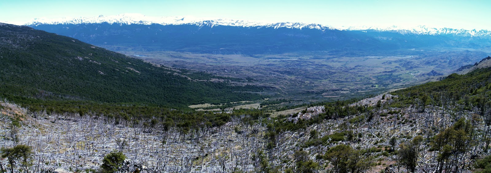
As we ascend, puffing and perspiring, through southern beech forests to the tree-line, the landscape slowly reveals its narrative. The forest is a mixture of small patches of mature woodland, large areas of young trees re-growing through the silver, horizontal corpses of their progenitors, and bare grassland with thousands and thousands of timber skeletons scattered like a giant’s matches. Looking back, the congregation of new and old buildings from where we have just walked appears miniscule in the broad, grassy valley of the Rio Chacabuco, guarded by impressive snow-capped mountains and contorted volcanic terrain. The valley relates in microcosm man’s misuse of the fragile lands of Patagonia. Just a few years ago the valley was once home to 30,000 sheep and 4,000 cattle, which out-competed the resident guanacos – the main food for the puma. So, the puma turned to eating sheep, and shepherds turned to hunting pumas. The diminishing grass cover laid bare fragile soil to erosion. The forest was cut and burned to provide more grazing – some of the fires burning unchecked or weeks – and 500 kilometres of fencing dissected the land and stymied the movement of wild animals.


Kate among forest remnants


Large-scale forest destruction viewed northwards across the Chacabuco valley


Conservacion Patagonica bought the 200,000 acre ecological disaster of the Estancia Chacabuco in 2004. Further lands have been acquired and accreted onto the Chacabuco empire. But why here?


The valley is at the heart of the transitional zone between the semi-arid Patagonian steppe to the east and temperate southern beech forests to the west, hence it has an important diversity of habitats and creatures in an ecosystem that is under-protected globally. The area is also home to one of the largest remaining populations of the endangered huemul deer. Also, the valley connects two nationally protected reserves. The intention is to combine all three areas and upgrade the overall conservation status from national reserve to national park – the Patagonia National Park – which it is hoped will become as internationally iconic as Yosemite or Torres del Paine. The visitors it will attract will under-pin a new economy based on tourism and more sustainable methods of farming and forest management.


Yours truly at the top
Most of the sheep and cattle have been sold off and Conservacion Patagonica workers are removing fencing, restoring grasslands and building trails for visitors, including the one we are now hiking. We are heading for a small, post-glacial lake for lunch. I am accompanied by Lisi and Jane, my two American Carretera soul-mates, and Kate, Matt and Jordan – interns on the project. (I suddenly realize that I am the only non-American in the group – and here we are in the middle of nowhere half-way up a mountain in southern Chile. Weird!) As the others head down to the lake I entice Jane to accompany me up a nearby peak of black rock off-set by a perfect blue sky and patches of snow. She is reluctant at first, until I promise a surprise at the top! After 20 more minutes of puffing and perspiring we reach the pinnacle of Monte Tamanguito. The 360-degree panorama of mountains, valleys, forests and lakes is jaw-droppingly spectacular. To the east – and Argentina - the dryness is apparent – and this is where I’ll be heading in a couple of days’ time. To the south, the glacier-collared, border straddling, 3,700-metre hulk of Monte San Lorenzo dominates the horizon and magnetically draws my gaze. We sit on a lump of old lava, out of the wind, and I dig into my rucksack to extract a large, unopened Christmas cake, which I bought in Coyhaique a couple of days ago. Jane appreciates the surprise and together we eat almost all of it!

View south to Monte San Lorenzoe or Cochrane on the Chile - Argentina border

The journey down is harder than the way up. My old rugby knee injury doesn’t do downhill, so I fall way behind and lose the trail. I can see where I need to get to though; I just have to fight through a dense thicket of young southern beech trees re-growing through the ankle traps of their fallen parents.


Lunch-time
After our picnic lunch sitting on rock watching wheeling Andean condors, we take a hypothermia-inducing dip in the lake. Post dip, we dress quickly partly to avoid the onset of hypothermia, but mainly to protect ourselves from horse-sized horse flies. But to no avail; the buggers even bite through our clothing – and they appear to love the taste of Yorkshire men!


We gradually descend through a natural adventure playground of unimaginable volcanic rock formations, forests, rivers and lakes. And the sun beams down kindly. Approaching the estancia we are aware that we are being watched. On a rocky outcrop above us, three guanaco sentinels check our progress, chattering urgently amongst themselves.

Guanaco sentinel

Back at the impressive Chacabuco Lodge, we settle in the luxurious dining room - come bar - come library, flooded by the mellow light of the setting sun. We are tired and relaxed and amazed by the story of this place and the lessons it offers. Over the next couple of days we will discover more about the landscape and its restoration and the dedicated people who work here. They generously offer us fantastic hospitality and their precious time to explain their work and their lives. This is a truly uplifting and inspiring place and I, for one, will be sorry to leave.


Saturday, 7 January 2012

With Thelma and Louise on the Carretera Austral


After my final, home-cooked breakfast before the homey open fire in Caleta Gonzalo’s cozy cafe, I re-pack of my enormous sack – something at which I am now becoming adept. Leaving my cabaña for the last time I stumble across the rocky beach to welcome Lisi and Jane back onto dry land from their small boat from Reñihue. They are both American and they are accompanied by an affable Argentinian chap, called Rafa, and his wife (more of whom in a later blog). (Lisi, Jane and I first met briefly a few days ago on the ferry rides between where we are now and Puerto Montt – the origin of our Patagonian adventure.) With some trepidation I am about to embark on a journey into the unknown with two people I hardly know,  for several days within the tight confines of a Nissan X-Trail 4WD.

Caleta Gonzalo cabanas


Caleto Gonzalo cafe, with a garden of native plants

Carlo and his wife
I splutter Spanish goodbyes to Carlo and his lovely wife the king and queen of Caleta Gonzalo and, together with Lisi and Jane, depart the fairytale settlement aiming south on the single-lane, gravel (ripio) Carretera Austral (also the southern end of the trans-continental Pan-American Highway). It’s a bright, sunny day as we motor through the forest and mountains towards Chaitén. We stop briefly at the Chaitén volcano trail that I visited yesterday with Carlos to show them the devastation down-slope of the still steaming volcanic blister (see last blog). We also hop out at Chaitén town for quick pics of half-buried houses. We stop for petrol at the pleasant little village of El Amarillo, at the southern gate of Pumalin Park. Here, park people are working with local home-owners to spruce up their buildings to enhance the area’s tourism potential. At the smart, new grocery store we stock up with essential supplies – chocolate, crisps, biscuits, Pumalin park honey, walnuts and more chocolate – and continue on our journey. Beyond El Amarillo and the gates of Pumalin we enter uncharted territory – a strange new world, boldly going where none of us have gone before.


Route of Carretera Austral through Pumalin Park; panorama over Lago Rio Negro


El Amarillo house after aesthetic improvements

Volcan Michimahuida + ice cap, from El Amarillo, with typical Pumalin farm fencing

The first few hours are relatively easy driving, considering that the Carretera is a single-lane gravel road. The road runs relatively straight along the long, narrow valleys of the Rio Yelcho and the Rio Palena, skirting the Corcovado National Park and its eponymous, perfectly conical volcano. Corcovado National Park is the outcome of another inspirational Conservation Land Trust/ Tompkins project.

Crossing the Rio Yelcho

The snow-capped cordillera funnels us southwards as isolated farm shacks appear sporadically alongside the road to remind us that humanity still exists. Each farm occupies land that was beautiful Valdivian rainforest just a few short decades/ years ago as told by the remains of fallen timber giants and jagged stumps – some still blackened by clearance fires. Cows, horses and the odd sheep graze amongst the wooden debris. Some field boundaries are demarked by vertical sections of cut tree trunks implanted adjacently (are these fences or walls?). Occasionally pastures are returning, gradually, to forest, the hot oranges of the re-growing Chilean fire bush turning distant hillsides ablaze with botanical fire. Intermittently, and with decreasing frequency as we drive on, we happen upon small communities of timber buildings. With each passing mile we are heading ever deeper into the wilderness and I wonder, as usual, how people make a living along this gravel road.

Small village church along the Carretera

Travelling in forced proximity with strangers is a fascinating experiment in human relationships – remember the film Thelma and Louise? In our version of the celluloid story I guess, by default, that I must be the Brad Pitt character – a respectfully toned-down version I hasten to add! Initially our discussions are rather polite, even professional, focusing mainly on our independent Pumalin experiences over the past few days and our respective jobs. There are few awkward pauses in conversation though, which augers well for the future of this journey. Lisi is an ecological economist and I am keen to discover what one of these is – but not that keen – so we park that conversation for later. Lisi drives for the first few hours, with her thankfully vast experience of gravel road driving in Wyoming/ Montana. By the way, the winner of the self-made snack competition was Jane’s walnut and Pumalin Park honey combo! Heston Blumenthal eat your heart out!


After 165 km we reach Puyuhuapi the largest village for hours, but with a population of only 500, located at the head of a long, sea fjord. Founded in 1935 by ethnic Germans, the village is (apparently) world famous for alfombras (carpets)! We don’t stop.

By now I’m driving. The Carretera Austral takes a turn for the worse and continues in that vein for the much of the rest of the day. After Puyuhuapi it contours and sinuates along the edge of the fjord, carved out of the cliff-face, single-laned, corrugated, pot-holed and with nothing to guard against the 100 foot drop to the sea below. In a matter of minutes we’ve gone from Thelma and Louise to the Top Gear Christmas special! It’s probably the most dangerous road I’ve ever driven on; there’s no warning of on-coming buses and lorries, but thankfully they arrive from nowhere only once every half an hour or so. We meet about four vehicles an hour and the occasional pairs of heavily-laden cyclists about to eat our dust! The lack of traffic has the effect of lulling one into a false sense of security. On one instance I glanced sideways, momentarily, at the map being read by Jane in the passenger seat only to be jerked back to reality by weird, voluminous animal noises emanating from back seat Lisi. Instinctively I looked up to have my vision filled by a looming Mercedes-Benz logo on the radiator grill of an on-coming truck. I braked and swerved into the edge as two lorries scraped past – we ate their dust! Lisi (Thelma) had been rendered speechless as she saw the scene unfolding and was only able to warn us through some primeaval, residual jungle tongue from the depths of her subconscious. Anyway, it did the trick.

With Thelma and Louise hanging on the edge of Puyuhuapi fjord

After a nerve-settling break we carried on for a few minutes, only for the car to hit loose gravel beyond the imprinted dusty tyre tracks down the centre of the road. I momentarily lost control as the car skidded on marble-like stones. Like Top Gear’s Clarkson, I steered into the skid as the superficially vegetated, sheer drop arrived in slow motion, through a cloud of road dust. Thankfully the Nissan had chosen its moment to lose control by the only crash barrier for hundreds of kilometres. We stopped within millimetres of it. Thelma, Louise and Brad breathed a collective sigh of relief, giggled nervously, and then rested our jangled nerves again.

The Carretera continues inland, gaining altitude, and we climb mountain sides via an endless series of hair-pin bends (or switchbacks if you’re American). Lots of minor skidding on the steep, gravelly bends, but we manage and have a long break at the pass on the tree-line surrounded by majestic peaks, knowing that descending the other side will only be worse. It is. But, again, we survive.

Mountain pass

It’s now getting late the light is mellowing, the shadows lengthening, and I’m growing secretly anxious about negotiating this road in the dark. Then, out of nowhere, a short, black ribbon of tarmac appears, sporadically at first, then becoming continuous, and we motor along the curvaceous, new, empty road at (relatively) high speed, through river valleys carpeted with (introduced) purple lupins.

Lupins

Coyhaique (population 44,000) is the biggest town for hundreds of kilometres and is located in a mountain bowl. Lit by an orange setting sun as we approach, it’s a very welcome sight after 12 hours of gruelling driving. Our only thoughts are food and bed. Jane’s excellent urban map-reading finds our germanic bed and breakfast easily. We check in, go out, eat pizza, drink pisco sours, then sleep. We’ve got it all to come again tomorrow!

To be continued…

Saturday, 31 December 2011

Pumalin Park, Patagonia. Part 2: Volcano


We drive then clamber through a forest of skeletons to reach ground zero: flattened trees, decapitated trunks, all-consuming silver-grey ash and rock debris, with a seething mountainous blister backdrop – the Chaitén volcano. Its steam and pervasive eggy smell foretell a still angry volcano god, but scientists assert he is gradually calming down after his 2008 eruption that affected life in this part of the world so much. I’ve never seen anything like this before and struggle, in awe, to imagine what it must have been like here meeting the catastrophic force with the power to snap a four-foot tree trunk like a corn stem.


On the Carretera Austral approaching the forest of skeletons in the distance


Volcan Chaiten steaming angrily in the background

This vista and the drive to get here reinforces in my mind that Patagonian Chile is a geological contortion of immense proportions – a union of geo-forces that contrive a unique landscape – tectonics, volcanoes, wind, rain, sea, ice and snow, and biology. It’s raw, wild, isolated, and spectacular and the people who live here remain at the mercy of these elements, despite their attempts to civilize the land.


Return of the Nalca
Back by the blister in the forest of skeletons, we walk along the new trail being developed by Carlos’ team that will eventually take hikers to the edge of the rusty, steaming dome above us. Among the grey ash and white wooden bones, patches of green re-affirm nature’s own restorative powers without the need for our helping hand. A fern here, a fuchsia there and, most surprisingly to my Cornish garden eyes, gunneras everywhere. Gunneras, iconic garden plants of the country homes of the Cornish gentry, are sprouting everywhere. In Chile they’re called nalcas and there’s a range of different species. Here their leaf stalks used to be eaten in salads or made into marmalades. 


The Chaitén eruption forced the closure of the popular southern part of Pumalin Park for three years as roads were blocked for miles with fallen trees and assorted mineral debris. They have only very recently been re-opened and Carlos is hoping that this summer will see visitor numbers increase. After motoring through forests shadowed by ice-capped mountains and passing reflective lakes, we arrived at the beautifully-appointed El Volcáns camp-site on the flat valley floor of the Rio Rayas, which has just been restored to its former glory after the eruption. It was originally built on a site devastated by poor forestry practices; now, the new buildings and camp-site shelters continue the Pumalin design tradition that I am coming to expect. The camp-site will re-open in the next few days


The regional town of Chaitén was almost erased from the map as the eruption smothered buildings and roads under several feet of volcanic ash, transforming the local geography. The authorities did a sterling job evacuating the population – apparently no-one died – but in the aftermath wrote the town off. Today, over three years since the earth burped, the local geography remains transformed: the beautiful bay is now a new delta of volcanic debris, the town’s river sports the skeleton of a fragmented timber building and many others remain half buried with grey ash. Rows of empty homes and businesses tell that many residents did not return; those that did seem to be slowly turning the volcanic tide. Tourist accommodation is increasing, reflecting the main economic driver based on the surrounding natural splendour. And all the time, the volcano, one of three in the immediate vicinity, steams ominously to the north at the head of its eponymous valley.


Another skeleton forest - view from the back
El Amarillo is a small, roadside village at the south entrance to Pumalin Park, where we stop for lunch. Then Carlos, Irwin – the head of this sector of the park – and I head up the valley to hike a new trail being constructed to an old camp site. Irwin and Carlos are evidently used to this kind of uphill hiking thing as the distance between them and me gradually lengthens, making me feel like I’m walking backwards – I use the excuse that I keep stopping for photos! The trail up is beautiful and courses by the side of the fast-flowing, turquoise Rio Amarillo. As we increase in altitude through the forest, volcanic ash grades from a light dusting to a two-foot coating and the trees around us turn from vibrant spring leaves to silver-grey standing dead – the day’s second skeleton forest. We are a few miles southwest of the Chaitén volcano, but it’s hidden behind an intervening mountain. However, we do have spectacular views of its larger volcanic neighbour, Volcán Michimahuida, with its permanent ice cap and tumbling glaciers. Michimahuida is less explosive that its recently eruptive companion as its more fluid basaltic lava flows rather than explodes; it is this black rock that the river is slowly eroding.


We reach the top of the hill, in the middle of a post-apocalyptic volcanic wasteland, to suddenly happen upon a surprisingly fresh, green field. My first (speechless) reaction is ‘golf course’ – incongruous as it appears, until Irwin explains that this is a very recently restored camp site that was inundated under metre of ash when Chaitén let rip. His team has just finished removing and leveling the ash and planting new grass. They intend it to be open for the first time in three years within a fortnight.


View from the restored camp site: Volcan Michimahuida and one of its glaciers


Gulley in place of the original path
The path we have just walked up is also the way down; however, Irwin is keen to show us the old path that is no longer usable after the damage inflicted by Chaitén. We pick our way through an arboreal obstacle course of fallen trees and use thin trunks as improvised bridges to cross four metre deep, blackened gullies where the path once ran. Quite exciting but, darn it, I just can’t keep up with those boys!


Hidden path

A couple of hours later after a quick drive back, I am in Pumalin’s excellent Caleta Gonzalo café. Carlo and his wife, as usual, serve me scrumptious, home-cooked, local food. It’s getting dark outside and will be a much cooler night than of late. The local ferry has just broken down causing a queue of waiting vehicles up the slipway. Their occupants – people of all ages – are huddling around the welcoming, crackling wood fire in the corner of the café so, for once, I am not eating alone.
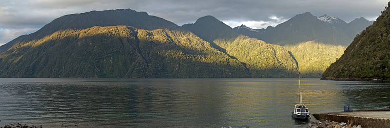
Last night: Renihue Fjord from Caleta Gonzalo

Tonight is my last night in Pumalin Park. Tomorrow I venture south on a long road trip along the Carretera Austral with two people I don’t know, for several days of who knows what experiences in the wild wilderness of Patagonia. Bring it on!