Saturday, 18 February 2012

From Nowhere to Somewhere


Drawing back the curtains, the early morning view from my small bedroom window at the Estancia Menelik is filled with the stunning Andes of the Perito Moreno National Park – Argentina’s remotest national park. Before breakfast I wander around outside taking photos of this unique circumstance and contemplate what happens next. The daily activities at the estancia are already underway as the farm’s gauchos round-up their horses.

Estancia Menelik looking west-ish towards the Andes


Estancia Menelik looking east-ish (apologies for the dog!)


After breakfast and goodbyes, Lisi, Jane and I – still bewildered with the remote new world we have discovered over the past few days – decide to drive the 20 or so miles west to the park on the remaining petrol fumes in our tank, along the dirt road from nowhere to nowhere, before heading off into who knows where for the long drive to El Calafate – our ultimate objective for the day. Early morning rheas, presumably after early morning worms, scatter as we approach the mountains.


The park is a heady, geological cocktail of wild mountains and stunning lakes dominated by the imposing peak of Monte San Lorenzo (also known as Monte Cochrane), which marks the Chile-Argentina border, the north side of which is not too distant from Valle Chacabuco in Chile, where we started this journey; since early morning yesterday we have driven a horse-shoe of a couple of hundred miles. We keep pushing, like surfers promising themselves that the next wave will be their last of the day, for the best view, limited by our time and fuel situation. Eventually we stop for a few minutes on the dirt road, take our obligatory snaps then head back, as the Andes diminish in our rear view mirrors for the second time in two days.

Perito Moreno National Park

We settle into our customary physical and mental states and progress along the empty dirt road, trailing a cloud of dust, towards the Ruta Cuarenta (Ruta 40). Suddenly, a dark-coloured aeroplane swoops low from nowhere immediately in front of us. Closer inspection reveals finger-like terminal wing feathers indicating that this plane is an Andean condor. It glides a few feet above the ground, watching us for a few seconds, before deciding we are too boring to bother with and veers off, skimming over the low mounds of vegetation into the distance.


Alejandre
The fuel situation is now critical and we are over 150 miles from the nearest town, so we have no choice but to pull into the isolated, single-storey white building described in the last blog post. Wary of chainsaw murderers and the rest, it appears more inviting in the late afternoon sun than it did in yesterday evening’s twilight. And the bleeding, butchered cow carcass is now hidden around the back! We park up and wander in, timidly, to be met by an unexpectedly welcoming whirlwind of Argentine humanity – Alejandre. His English is perfect and he invites us in for a coffee and seats us in the lounge area of his establishment – which serves as an impromptu emergency fuel station for people like us and a sort of roadside café, except there is no real road, it is not on the roadside and there are hardly any people. I ask him how many people he services with fuel. Last month (November), apparently, only five cars stopped here for petrol – I guess it’s not quite the height of the season yet! The lounge has views over the top of the river cliff to wild expanses of emptiness and beyond. Alejandre built this place himself and shows us through old photographs of its construction and his family.


Eyes onto nothing, from Alejandre's lounge window


Wary of overstaying our welcome, we gingerly ask for petrol – worth more than its weight in gold in these parts. In the strong, incessant Patagonian wind we pour petrol into the car through a funnel, and some of it even goes into the tank! With our Nissan now fed with 20 litres of fuel, we continue our journey. Alejandre briefed us that we should aim for the distant town of Gobernador Gregores where a new petrol station has new petrol for sale and that is the only (almost) guaranteed fuel supply for over 300 miles. It just means that today’s planned mammoth journey will be extended by an extra 60-mile dog-leg.


Back on the Ruta 40 we head south. Re-assuming our Nissan mental and physical driving positions I, for one, feel that I am becoming desensitized to the spectacular emptiness. By way of alleviation we enter ipod heaven and play Mumford and Sons and Adele’s “spectacular new album” 21 – the sound track of my entire journey to date, with its songs emanating from every bar, shop and car radio from Appalachia to Patagonia, and everywhere in between.


Most of the Ruta 40, save a few kilometres near Gobernador Gregores, is dirt road, although over large distances is at least relatively straight and reasonably graded. It is the subject of a major national economic undertaking, being upgraded over hundreds and hundreds of miles to eventually become a black-top, tarmac road. Lisi and I wonder at the cost, time-scale and necessity of this. Bizarrely, as we trail our cloud of dust ever southwards, we encounter small gatherings of bright yellow earth-moving and road-making machinery in the middle of nowhere wondering how on earth they got here and where are the people who use them? In this land of the real dinosaurs, they appear simultaneously unsettling, but normal. (Or maybe my brain has finally forgone trying to understand normality any more).


We reach Gobernador Gregores - a reasonably-sized, windswept town with one main street and lots of new buildings. Unsurprisingly, the only functional petrol station for hundreds of miles in any direction is rather busy. I ask the station chap, in rubbish Spanish, how we can get back on the Ruta 40 without driving back the way we have come. Even if I understood Spanish properly I doubt his grunted instructions would have made sense. So, we just take off and head in what seems to be the right direction (after cruising up and down the main strip a few times to work out what was what). Eventually we stumbled on the only road going south and, ignoring a road-closed sign, took a 40-mile, half-built, black-top road back to the Ruta 40.


Tantalising black-top, but no way Jose!
For the rest of the day we drive (almost) on the Ruta 40, on the ripio tracks alongside the newly-constructed tarmac strips, but we are not allowed to actually drive on it. Tantalisingly, the ripio route regularly crisscrosses the new tarmac; occasionally feeling brave, we ignore the signs and revel in the pleasure of a few miles of vibration and dust free motoring, singing to Adele.
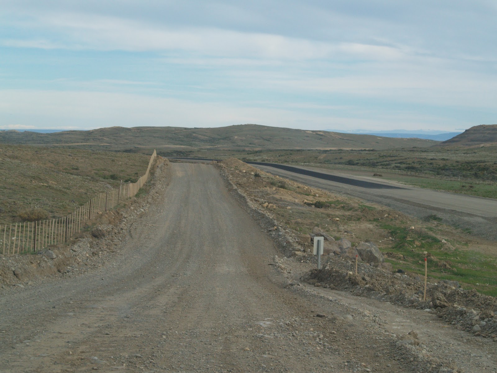


The landscape changes again - for long distances it is flat and featureless; the Andes to the west test our eyes with their distance before melting back into the horizon. During hours of driving, inevitably nature calls, but there are no bushes, rocks or banks to hide our modesty. However, we work it out, as you do, with our dignity intact!


Landscape and sky combine creatively producing unexpected, freaky effects. On the shimmering horizon we see the inviting turquoise of Lake Viedma, yet the map shows it to be at least 40 miles distant. As we approach, the lake doesn’t get any closer and then it just vanishes! We have just experienced a mirage – another 30 minutes of driving take us to the real thing.


It’s getting late now and we are still no nearer El Calafate, our objective for the day. Getting peckish we decide to explore the food options at the unpromising, small town of Tres Lagos. On entering the quiet, wind-blasted town, we park up at the kerb. Strangely, our innate senses have placed us directly outside the best cake shop and bakery in the southern hemisphere, and it’s open! And, just around the corner, we happen upon a small, but perfectly-formed, grocery store. Fully stocked with sweet things, we continue our journey.


The sun is setting. We are tired. Our bones and heads hurt from rattling roads. And our teeth ache from sweet things. However, the mental drama of yesterday’s journey does not repeat (see last blog post). Some distance from El Calafate we meet a new, smooth section of the Ruta 40, which steers us around the spectacular eastern end of Lake Argentino. We take a right to head west back to the Andes, along the shores of the lake, and enter El Calafate, the largest town we have seen for a week and our home for the next three days.

Evening sun over Lago Argentino, looking west

Sunday, 12 February 2012

From Nowhere to Nowhere through Nothing


I’m afraid this blog posting is rather longer than usual, but it describes a particularly profound travel experience that I wanted to share. So, please grab a coffee and a biscuit, put your feet up for ten minutes, and enjoy!


Excruciating embarrassment by proxy is the best way that I can describe the unfolding scene.
Downtown Baja Caracoles

The late afternoon Argentine sun, filtered through dusty windows and casting long shadows, illuminates a tranquil interior; five mustachioed gauchos, dressed in their traditional working clothing of bombachas de campo (baggy trousers), black leather boots, baggy shirts, neckerchiefs and berets, are enjoying cool beers after a day of being sand-blasted by the wind and dust of Patagonia. Suddenly, a car-load of European blokes/ tourists/ travellers pulls up outside our stone building. On entering the bar/ shop/ petrol station one of the party, without invitation, grabs a beer and rudely implants himself, posing for pictures in front of his goggling mates, among the previously oblivious gauchos, destroying their privacy and our moment of peace. A list of coarse Anglo-Saxon idioms springs to mind!


The bar itself doubles as a shop counter behind which, from floor to ceiling, are shelves bending with the daily provisions of humanity being searched for tasty snacks by Lisi, Jane and I. It is, apparently, the only shop for possibly 100 miles in every direction – and the only petrol pump – hence our arrival at this wind-swept outpost of civilization called Baja Caracoles.


Heading east out of the Chacabuco Valley towards Argentina
We had set off in our Nissan four-wheel drive from the broad valley of the Rio Chacabuco on the Chilean side of the Andes mid-morning. After 10 days we had left behind the densely wooded mountainsides of Chilean Patagonia to be replaced, in the space of a few miles, with sparse grasses and low mounds of muted shrubs. The ripio track was forced ever closer to the bubbling, turquoise river by brooding mountain casting a menacing shade. The valley funneled us towards the eastern promise of Argentina through a gorge with a valley floor occupied solely by the river and the track. Re-born, we emerged from the claustrophobic confines of the gorge into the brightness of expansive, dramatic skies and an unexpected, tortured Tokienien geography of impossible pinnacles, rugged terraces, and emptiness filled only with the noise of the incessant wind.


A collection of small wooden shacks nestled at the base of a mountain and surrounded by poplars marked the Chile – Argentina frontier at Paso Roballos. As we were taking a hire car through, the border rigmarole took a lot longer than it should have, considering that we were the only people for miles in any direction. I asked the Chilean border guard in embarrassing Spanish how many people passed through this isolated border crossing every day. He answered, “Five on average”. We set off into No-Man’s-Land across the eastern piedmont of the Andes, across a plateau of freaky rock formations and a lake containing two pink flamingoes. After a couple more miles of desolation, another motley collection of shacks and poplars marked the Argentine border. Again, the hire car paperwork was interminable. And, again, I asked the same question of the border guard. His surprising response was 15-20 people on average! There were no turnings or junctions or anywhere to come from or go to on the wild track between the two border posts so, either 10-15 people per day disappear in this displaced Bermuda Triangle, or someone can’t count, or they just made it up to humour me.

Chilean frontier at Paso Roballos


On this journey we discovered one of Patagonia’s many enigmas: that distance indicated on the map bears no relation to the time reality of getting there, and the routes marked bear only an occasional and passing resemblance to what might have been the reality some years before. As we drove through a post-volcanic landscape of eroded lava flows and impossibly turquoise lakes under a majestic sky, it dawned on us that, over the past few days, we have crossed the Patagonian Andes from the Pacific to the Argentinian wilderness – another contributory factor to our collective and growing bewilderment.


In four of hours of driving to and from the border we did not see one other vehicle and the only humans were the two border guards. The vibrations, banging, skidding and dust plumes of our journey sent us into a kind of trance. And, although there were three of us sharing the car space, the sense of isolation and loneliness became almost tangible. The long periods of silence reflected not our boredom with each other’s company, but introspection as we attempted to make sense of just how and why this incredible environment had affected us so profoundly.


The occasional bleached skeleton cliches of unfortunate cows and sheep sign-posted the harsh world outside our metal sanctuary, while large ‘suicide’ rabbits with extra-long legs played chicken under the wheels of our car – probably the only car of the day. An armadillo scuttled across, similarly suicidal. A rhea, like a South American ostrich, fled from our appearance, trailing 16 mini-me youngsters. And, just for reassurance, the odd guanaco looked down on us. There are evidently living domestic animals here too – particularly sheep and cows – as we pass through large areas of overly-clipped and sparser vegetation.


"When you reach a fork in the road, take it!"
Getting lost in this featureless terrain could be serious – there are no other cars, or houses, or petrol stations or anything! Enigma number two: in this part of the world, how does anyone actually reach their destination? Road junctions appeared from nowhere, they were not marked on the map, and there were no signposts! At one such junction, Lisi/ Thelma quoted that great travel philosopher Yogi Bear, who apparently said at just such an instance, “When you reach a fork in the road, take it!” We understood what Yogi was saying – go on instinct. We did at several junctions and eventually reached our destination without running out of petrol or dying of thirst or starvation. A minor miracle!


Relieved but dusty we arrived at the single, rusting petrol pump in the windswept, run-down settlement of Baja Caracoles on Argentina’s legendary Ruta Cuarenta (Ruta 40). Unable to figure out how to use the pump, we entered an adjacent, single storey, stone building – the Hotel Baja Caracoles, which seemed to be the only place with any human activity, to enquire about the pump and its mythical petrol. The shop doubled as the local pub for five authentic, mustachioed gauchos sipping bottles of beer after a hard day battling the great outdoors. And this is where this story began…

…We give up on the petrol as the pump is apparently empty, or not working, and press on chasing the sun as it sinks ever lower. I take over the driving. We are attempting to reach an estancia out there somewhere in the featureless, windy wilderness, but we are running short on those critical elements of travel survival – fuel and time. (Food is not a problem as we stocked up with chocolate and biscuits in the gaucho pub-shop!)

We are on the Ruta 40, which despite being the main transport artery through western Argentina is still a dirt road, albeit wider and generally straighter than what we have become accustomed to. The road is gradually being upgraded to a tarmac version, which will take years to complete the hundreds of isolated miles that it runs. Occasionally, and for no more than a few tantalizing miles, a short section of new black top is open to cars, before you are frustratingly diverted back onto the gravel.

Argentina’s awesome Patagonia is a stage built by geology and time upon which the sun, clouds and wind act out their daily dramas – humans are insignificant, bit-part extras. The horizons are endless, the sky is huge and the space is overwhelming, simultaneously instilling insecurity. Psychologically, I don’t know what to make of it and I know the others feel the same.


We plough onwards into the loneliness, towards a sinking sun and its mellowing light. We are aiming for the isolated Estancia Menelik, recommended by Rafa whom we originally met back in Pumalin Park’s Caleta Gonzalo what seems like years ago. Rafa, an Argentinian gentleman, is working with various estancias in Argentina to improve their environmental credentials and develop tourism. An estancia is, essentially, the Argentinian equivalent of a cattle/ horse/ sheep ranch and most of them are incredibly isolated, windswept and self-sufficient and can cover tens of thousands of hectares. We are desperately hoping to reach Estancia Menelik before it gets dark; however, we are running short of fuel, it’s a long way to drive (at least two more hours) and, because of a communication mix-up, we’re not even sure they know we are coming.

The road to Menelik


For an hour we have been driving south and parallel to the Andes, which occupy the horizon on our right. Eventually we take a right turn off the Ruta 40 onto the gravel road west that leads to the Perito Moreno National Park, as we know that 60 km back towards the Andes is the Estancia Melenik. We pray that it will sell us some petrol because tomorrow we will have to drive at least 150 km till the next town and petrol station and we ain’t got enough juice in the tank to do that! Every 10 km or so we pass a small, wooden sign, hand-painted with the name of an estancia and offering overnight accommodation, pointing to nowhere. But out here in the mad, darkening wilderness we don’t know how welcoming that accommodation will be.


We are tired and bewildered at the sensory overload of the day; our situation levers us into partial hysteria as we discuss the horror films of our youth that revolve around the notion of a car of naïve travellers losing themselves in the wilderness, seeking help at a lonely farmstead… At that point the car’s fuel indicator encourages us to make a decision: we feel pushed to take a risk at the next estancia and seek fuel and accommodation as the sun has now vanished below the horizon, leaving in its wake a multi-coloured tapestry of clouds.  
Rheas at sunset

Turning off at a sign-post to nowhere, we gingerly negotiate a track along the edge of a dry river cliff and approach an unwelcoming, single storey, white building. As we get closer we notice a beat-up old truck and the harsh light of an unshaded bulb invading the twilight. We mutter between ourselves about the superficial similarity to scenes in the film, The Texas Chainsaw Massacre, just as Lisi and Jane release garbled squawks of urgency; they’ve noticed the freshly butchered carcass of a cow, hanging from a hook and chain, swaying  in the wind, dripping blood into a pool of red liquid beneath. We depart rapidly. If our fuel expires, then we are happy to sleep in the car (locked!) or in the bush (hidden from chainsaw-wielding murderers!).


I speed on along a skiddy dirt road. In nine hours of driving, we have seen only ten cars! We eventually reach the Estancia Menelik – an oasis of buildings in the middle of nowhere framed by the residual pink embers of the day glowing above the Andes to the west. Relieved, but hysterical, we’ve reached our destination to find that they were expecting us, and invite us into their welcoming, comfortable dwelling, at the end of one of the most bizarre days of my 44 years.

Monday, 30 January 2012

Patagonia Park


They call it the Future Patagonia National Park. ‘They’ are the workers, volunteers and interns working for Conservacion Patagonica, a charity established by Kris Tompkins, the former CEO of the Patagonia outdoor clothing brand (and wife of Doug); and ‘future’ because they are still creating it from scratch.


According to my map the Chacabuco Valley – a substantial piece of the prospective park – runs from the Carretera Austral in the west to the eastern mouth of the valley on the doorstep to Argentinian Patagonia. A 57 kilometre, single-track dirt road runs the full length of the valley eventually into Argentina (park this knowledge for the next blog!).


We are out for a day’s hike exploring the forests and mountains that overlook the nerve centre of the project – a curious combination of old estancia (farm) buildings currently serving as offices, etc., and brand new, stone-clad, copper-roofed constructions of high specifications, comfort and functionality and radiating, deliberately, an air of permanence. The buildings are sheltered by (introduced) poplar trees – characteristic of estancias in both Chilean and Argentinian Patagonia and planted as arboreal foils against the incessant winds descending from the Campo de Hielo Norte (Northern Ice Cap) to the west.

The impressive, new Chacabuco Lodge


Motley collection of buildings at the nerve centre of the future Patagonia Park, and a guanaco

Valle Chacabuco, view from the south
Some flowers

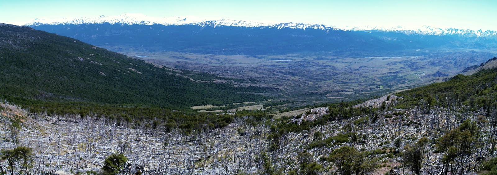
As we ascend, puffing and perspiring, through southern beech forests to the tree-line, the landscape slowly reveals its narrative. The forest is a mixture of small patches of mature woodland, large areas of young trees re-growing through the silver, horizontal corpses of their progenitors, and bare grassland with thousands and thousands of timber skeletons scattered like a giant’s matches. Looking back, the congregation of new and old buildings from where we have just walked appears miniscule in the broad, grassy valley of the Rio Chacabuco, guarded by impressive snow-capped mountains and contorted volcanic terrain. The valley relates in microcosm man’s misuse of the fragile lands of Patagonia. Just a few years ago the valley was once home to 30,000 sheep and 4,000 cattle, which out-competed the resident guanacos – the main food for the puma. So, the puma turned to eating sheep, and shepherds turned to hunting pumas. The diminishing grass cover laid bare fragile soil to erosion. The forest was cut and burned to provide more grazing – some of the fires burning unchecked or weeks – and 500 kilometres of fencing dissected the land and stymied the movement of wild animals.


Kate among forest remnants


Large-scale forest destruction viewed northwards across the Chacabuco valley


Conservacion Patagonica bought the 200,000 acre ecological disaster of the Estancia Chacabuco in 2004. Further lands have been acquired and accreted onto the Chacabuco empire. But why here?


The valley is at the heart of the transitional zone between the semi-arid Patagonian steppe to the east and temperate southern beech forests to the west, hence it has an important diversity of habitats and creatures in an ecosystem that is under-protected globally. The area is also home to one of the largest remaining populations of the endangered huemul deer. Also, the valley connects two nationally protected reserves. The intention is to combine all three areas and upgrade the overall conservation status from national reserve to national park – the Patagonia National Park – which it is hoped will become as internationally iconic as Yosemite or Torres del Paine. The visitors it will attract will under-pin a new economy based on tourism and more sustainable methods of farming and forest management.


Yours truly at the top
Most of the sheep and cattle have been sold off and Conservacion Patagonica workers are removing fencing, restoring grasslands and building trails for visitors, including the one we are now hiking. We are heading for a small, post-glacial lake for lunch. I am accompanied by Lisi and Jane, my two American Carretera soul-mates, and Kate, Matt and Jordan – interns on the project. (I suddenly realize that I am the only non-American in the group – and here we are in the middle of nowhere half-way up a mountain in southern Chile. Weird!) As the others head down to the lake I entice Jane to accompany me up a nearby peak of black rock off-set by a perfect blue sky and patches of snow. She is reluctant at first, until I promise a surprise at the top! After 20 more minutes of puffing and perspiring we reach the pinnacle of Monte Tamanguito. The 360-degree panorama of mountains, valleys, forests and lakes is jaw-droppingly spectacular. To the east – and Argentina - the dryness is apparent – and this is where I’ll be heading in a couple of days’ time. To the south, the glacier-collared, border straddling, 3,700-metre hulk of Monte San Lorenzo dominates the horizon and magnetically draws my gaze. We sit on a lump of old lava, out of the wind, and I dig into my rucksack to extract a large, unopened Christmas cake, which I bought in Coyhaique a couple of days ago. Jane appreciates the surprise and together we eat almost all of it!

View south to Monte San Lorenzoe or Cochrane on the Chile - Argentina border

The journey down is harder than the way up. My old rugby knee injury doesn’t do downhill, so I fall way behind and lose the trail. I can see where I need to get to though; I just have to fight through a dense thicket of young southern beech trees re-growing through the ankle traps of their fallen parents.


Lunch-time
After our picnic lunch sitting on rock watching wheeling Andean condors, we take a hypothermia-inducing dip in the lake. Post dip, we dress quickly partly to avoid the onset of hypothermia, but mainly to protect ourselves from horse-sized horse flies. But to no avail; the buggers even bite through our clothing – and they appear to love the taste of Yorkshire men!


We gradually descend through a natural adventure playground of unimaginable volcanic rock formations, forests, rivers and lakes. And the sun beams down kindly. Approaching the estancia we are aware that we are being watched. On a rocky outcrop above us, three guanaco sentinels check our progress, chattering urgently amongst themselves.

Guanaco sentinel

Back at the impressive Chacabuco Lodge, we settle in the luxurious dining room - come bar - come library, flooded by the mellow light of the setting sun. We are tired and relaxed and amazed by the story of this place and the lessons it offers. Over the next couple of days we will discover more about the landscape and its restoration and the dedicated people who work here. They generously offer us fantastic hospitality and their precious time to explain their work and their lives. This is a truly uplifting and inspiring place and I, for one, will be sorry to leave.


Tuesday, 24 January 2012

With Thelma and Louise on the Carretera Austral (continued)


Apologies for taking so long posting the second part of this journey along the Carretera Austral.

After a fine breakfast in our Germanic bed and breakfast in Coyhaique, we venture into the town centre to acquire provisions for the next part of our Carretera Austral adventure deeper into Patagonian Chile.


Downtown Coyhaique
This bustling town is the largest for hundreds of kilometres (population 45,000 and growing). There’s a lot going on on this island of civilisation surrounded by seemingly endless emptiness. Coyhaique was founded in 1929 and is now the equivalent of Keswick in the English Lake District, with its abundance of outdoor/ mountain sports shops. The Carretera Austral, pushed through this area in the 1980s, has driven the development of the town.


We find the supermarket and stock up on feel-good essentials like biscuits and Christmas cake for the long days ahead. Lisi buys a spare petrol can as petrol stations will be very few and very, very far between and there is no guarantee that they will have any fuel when you arrive.


Setting off, we head south through denuded, pastoral terrain. The new, black-topped road glides us smoothly through empty panoramas. Volcanic bluffs intimate a violent past, with lurid green layers sandwiched between darker basalts, or sub-vertical, dark basalt columns reminiscent of the Northern Irelands Giant’s Causeway. Burnt orange and brown geological contortions contrast with the purity of the perfect blue sky and blinding snowfields as we motor through the Cerro Castillo National Reserve. Over the mountain pass, the still tarmacked road winds downhill with breathtaking views of impossible peaks and distant ranges.


Why the green layer? Answers on a postcard please.

Reserva Nacional Cerro Castillo

Cerro Castillo

Chilean Firebush

Eventually the black road ends and we are back on the familiar, rattling ripio for the rest of our journey, paralleling the Rio Ibáñez as it networks along its broad, flat valley floor. The standing and fallen silver timber dead extensively tell of great fires, logging and over-grazing reducing the valley to a meagre forest patchwork at best; the arboreal blanket of Patagonia has been laid threadbare over huge areas and its regrowth is hindered by repeated burning and over-grazing – it’s like this for hundreds and hundreds of miles. The forest is returning sporadically in some areas – maybe the fundo (farm) has closed – but it’s not yet enough to make a substantial difference. The occasional hardy cow grazes its way through the tragedy, oblivious.


We stop every few minutes for yet more photographs of yet more mountains. I already have hundreds (– it takes ages to pick the ones to include in this blog!). The benefits of driving yourself, compared to being in a bus or train, is that you can stop when and where you want for pictures, or for any other reason. And the joy of travelling with others who become friends, especially in the wilderness, enhances the experience and relieves you from the unsettling discovery of how boring you really are.


Rising through the valley of the Rio Cajon we approach an apparently impenetrable mountain wall of rock and glaciers. The Carretera skirts it, taking a sharp left down the densely forested valley of the Rio Murta to the shores of the Lago General Carrera. The lake straddles the border with Argentina, where it is called the Lagos Buenos Aires, and is the second largest lake in South America at 2,240 km2. The turquoise lake is squeezed between mountains, and the Carretera is squeezed even more tightly between the mountains and the shore. Every few minutes, from the seat behind me where Lisi (Thelma) is sitting, I hear a quiet, private gasp – usually containing an expletive or two – at the unfolding geographical drama enveloping us; it’s a sensory overload and it’s only going to increase.


We stop at the tiny village of Puerto Rio Tranquilo for lunch, entering a small café-shop for the empanadas (the South American equivalent of the Cornish pasty) it advertises outside. At the side of the room, otherwise filled with tables and small chairs, is a large chest freezer dribbling with blood – like a scene from a video nasty – as a lady butchers a sheep atop it. Gruesome, but at least the meaty empanadas should be fresh!


Lisi/Thelma and the Rio Baker
Back on the road we hug the lake shore south, glimpsing to the west the high peaks and glaciers bleeding from the Campo de Hielo Norte – the Northern Ice Field. Leaving the lake behind we trace the course of the Rio Baker – a deep turquoise, awesome river – its barely rippling, shimmering surface belying the power beneath. It’s the most voluminous river in Chile and we follow it for miles as it cuts through mountains like lava through ice.      


The elements of geographic beauty that forge such a majestic, natural spectacle are the same elements that conspire to make this river an ideal location for hydroelectric power. The Rio Baker is ear-marked to be tamed in Chile’s largest ever hydroelectric power scheme. And, despite the lack of people in the area, there is graffiti and posters on every turn proclaiming ¡Patagonia SinRepresas! (Patagonia Without Dams!). Personally, I believe the future value in these landscapes has to be in their unique, untrammeled, natural beauty and our aspirations of wilderness – that we all need to know that wild places exist as part of our human condition. A vocal pressure group, with some impressive backers, is determined to prevent the taming of the river in this way. And good luck to ‘em!

Is this the right place for a massive hydroelectric scheme?


Narrow artery through the Valle Chacabuco
This southern extremity of the Carretera Austral is really deserted; we see probably one other car every 30 minutes. The directions to our destination in the Valle Chacabuco are open to interpretation; we take the dirt road turning that “feels right” and then immerse ourselves into the wild end of wilderness. After some minor stressing we agree to give ourselves 8 km to achieve our goal, but we don’t really know what we are looking for! The gravel road narrows and a grass strip gradually emerges between its tyre grooves indicating the lack of traffic. A weird-looking creature – like a camel-sheep chimera or one half of Dr. Dolittle’s Pushmi-pullyu – appears in a small herd, lying in the road. Jane informs us that it’s a guanaco – a relative of the llama. It seems nonplussed, if not disdainful at our presence; but we’ll get used to their superiority complex over the next few days. Just as we feel that we are getting lost in the wilderness, a fully laden four wheel drive hurtles towards us trailing a cloud of yellow dust. The driver responds to our garbled Spanish request for directions with a pointed finger and grunts that we are virtually there. We carry on a few hundred metres to happen upon a complex of the most unexpected architecture and activity among the poplar trees (– characteristic non-native trees introduced by pioneering farmers during the 20th century as windbreaks around their estancias). We finally arrive at the Lodge of Estancia Chacabuco where we are met by a blue-eyed, blond, American lady called Kate, which serves to disorientate us still further. We are at the heart of Conservacion Patagonica’s future Patagonia National Park, and our bewilderment is only going to increase over the next few days. Story of my life!


A pushmi-pullyu too far!


Saturday, 7 January 2012

With Thelma and Louise on the Carretera Austral


After my final, home-cooked breakfast before the homey open fire in Caleta Gonzalo’s cozy cafe, I re-pack of my enormous sack – something at which I am now becoming adept. Leaving my cabaña for the last time I stumble across the rocky beach to welcome Lisi and Jane back onto dry land from their small boat from Reñihue. They are both American and they are accompanied by an affable Argentinian chap, called Rafa, and his wife (more of whom in a later blog). (Lisi, Jane and I first met briefly a few days ago on the ferry rides between where we are now and Puerto Montt – the origin of our Patagonian adventure.) With some trepidation I am about to embark on a journey into the unknown with two people I hardly know,  for several days within the tight confines of a Nissan X-Trail 4WD.

Caleta Gonzalo cabanas


Caleto Gonzalo cafe, with a garden of native plants

Carlo and his wife
I splutter Spanish goodbyes to Carlo and his lovely wife – the king and queen of Caleta Gonzalo and, together with Lisi and Jane, depart the fairytale settlement aiming south on the single-lane, gravel (ripio) Carretera Austral (also the southern end of the trans-continental Pan-American Highway). It’s a bright, sunny day as we motor through the forest and mountains towards Chaitén. We stop briefly at the Chaitén volcano trail that I visited yesterday with Carlos to show them the devastation down-slope of the still steaming volcanic blister (see last blog). We also hop out at Chaitén town for quick pics of half-buried houses. We stop for petrol at the pleasant little village of El Amarillo, at the southern gate of Pumalin Park. Here, park people are working with local home-owners to spruce up their buildings to enhance the area’s tourism potential. At the smart, new grocery store we stock up with essential supplies – chocolate, crisps, biscuits, Pumalin park honey, walnuts and more chocolate – and continue on our journey. Beyond El Amarillo and the gates of Pumalin we enter uncharted territory – a strange new world, boldly going where none of us have gone before.


Route of Carretera Austral through Pumalin Park; panorama over Lago Rio Negro


El Amarillo house after aesthetic improvements

Volcan Michimahuida + ice cap, from El Amarillo, with typical Pumalin farm fencing

The first few hours are relatively easy driving, considering that the Carretera is a single-lane gravel road. The road runs relatively straight along the long, narrow valleys of the Rio Yelcho and the Rio Palena, skirting the Corcovado National Park and its eponymous, perfectly conical volcano. Corcovado National Park is the outcome of another inspirational Conservation Land Trust/ Tompkins project.

Crossing the Rio Yelcho

The snow-capped cordillera funnels us southwards as isolated farm shacks appear sporadically alongside the road to remind us that humanity still exists. Each farm occupies land that was beautiful Valdivian rainforest just a few short decades/ years ago as told by the remains of fallen timber giants and jagged stumps – some still blackened by clearance fires. Cows, horses and the odd sheep graze amongst the wooden debris. Some field boundaries are demarked by vertical sections of cut tree trunks implanted adjacently (are these fences or walls?). Occasionally pastures are returning, gradually, to forest, the hot oranges of the re-growing Chilean fire bush turning distant hillsides ablaze with botanical fire. Intermittently, and with decreasing frequency as we drive on, we happen upon small communities of timber buildings. With each passing mile we are heading ever deeper into the wilderness and I wonder, as usual, how people make a living along this gravel road.

Small village church along the Carretera

Travelling in forced proximity with strangers is a fascinating experiment in human relationships – remember the film Thelma and Louise? In our version of the celluloid story I guess, by default, that I must be the Brad Pitt character – a respectfully toned-down version I hasten to add! Initially our discussions are rather polite, even professional, focusing mainly on our independent Pumalin experiences over the past few days and our respective jobs. There are few awkward pauses in conversation though, which augers well for the future of this journey. Lisi is an ecological economist and I am keen to discover what one of these is – but not that keen – so we park that conversation for later. Lisi drives for the first few hours, with her thankfully vast experience of gravel road driving in Wyoming/ Montana. By the way, the winner of the self-made snack competition was Jane’s walnut and Pumalin Park honey combo! Heston Blumenthal eat your heart out!


After 165 km we reach Puyuhuapi – the largest village for hours, but with a population of only 500, located at the head of a long, sea fjord. Founded in 1935 by ethnic Germans, the village is (apparently) world famous for alfombras (carpets)! We don’t stop.

By now I’m driving. The Carretera Austral takes a turn for the worse and continues in that vein for the much of the rest of the day. After Puyuhuapi it contours and sinuates along the edge of the fjord, carved out of the cliff-face, single-laned, corrugated, pot-holed and with nothing to guard against the 100 foot drop to the sea below. In a matter of minutes we’ve gone from Thelma and Louise to the Top Gear Christmas special! It’s probably the most dangerous road I’ve ever driven on; there’s no warning of on-coming buses and lorries, but thankfully they arrive from nowhere only once every half an hour or so. We meet about four vehicles an hour and the occasional pairs of heavily-laden cyclists about to eat our dust! The lack of traffic has the effect of lulling one into a false sense of security. On one instance I glanced sideways, momentarily, at the map being read by Jane in the passenger seat only to be jerked back to reality by weird, voluminous animal noises emanating from back seat Lisi. Instinctively I looked up to have my vision filled by a looming Mercedes-Benz logo on the radiator grill of an on-coming truck. I braked and swerved into the edge as two lorries scraped past – we ate their dust! Lisi (Thelma) had been rendered speechless as she saw the scene unfolding and was only able to warn us through some primeaval, residual jungle tongue from the depths of her subconscious. Anyway, it did the trick.

With Thelma and Louise hanging on the edge of Puyuhuapi fjord

After a nerve-settling break we carried on for a few minutes, only for the car to hit loose gravel beyond the imprinted dusty tyre tracks down the centre of the road. I momentarily lost control as the car skidded on marble-like stones. Like Top Gear’s Clarkson, I steered into the skid as the superficially vegetated, sheer drop arrived in slow motion, through a cloud of road dust. Thankfully the Nissan had chosen its moment to lose control by the only crash barrier for hundreds of kilometres. We stopped within millimetres of it. Thelma, Louise and Brad breathed a collective sigh of relief, giggled nervously, and then rested our jangled nerves again.

The Carretera continues inland, gaining altitude, and we climb mountain sides via an endless series of hair-pin bends (or switchbacks if you’re American). Lots of minor skidding on the steep, gravelly bends, but we manage and have a long break at the pass on the tree-line surrounded by majestic peaks, knowing that descending the other side will only be worse. It is. But, again, we survive.

Mountain pass

It’s now getting late – the light is mellowing, the shadows lengthening, and I’m growing secretly anxious about negotiating this road in the dark. Then, out of nowhere, a short, black ribbon of tarmac appears, sporadically at first, then becoming continuous, and we motor along the curvaceous, new, empty road at (relatively) high speed, through river valleys carpeted with (introduced) purple lupins.

Lupins

Coyhaique (population 44,000) is the biggest town for hundreds of kilometres and is located in a mountain bowl. Lit by an orange setting sun as we approach, it’s a very welcome sight after 12 hours of gruelling driving. Our only thoughts are food and bed. Jane’s excellent urban map-reading finds our germanic bed and breakfast easily. We check in, go out, eat pizza, drink pisco sours, then sleep. We’ve got it all to come again tomorrow!

To be continued…